
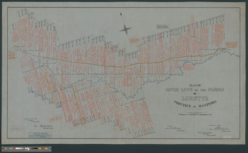
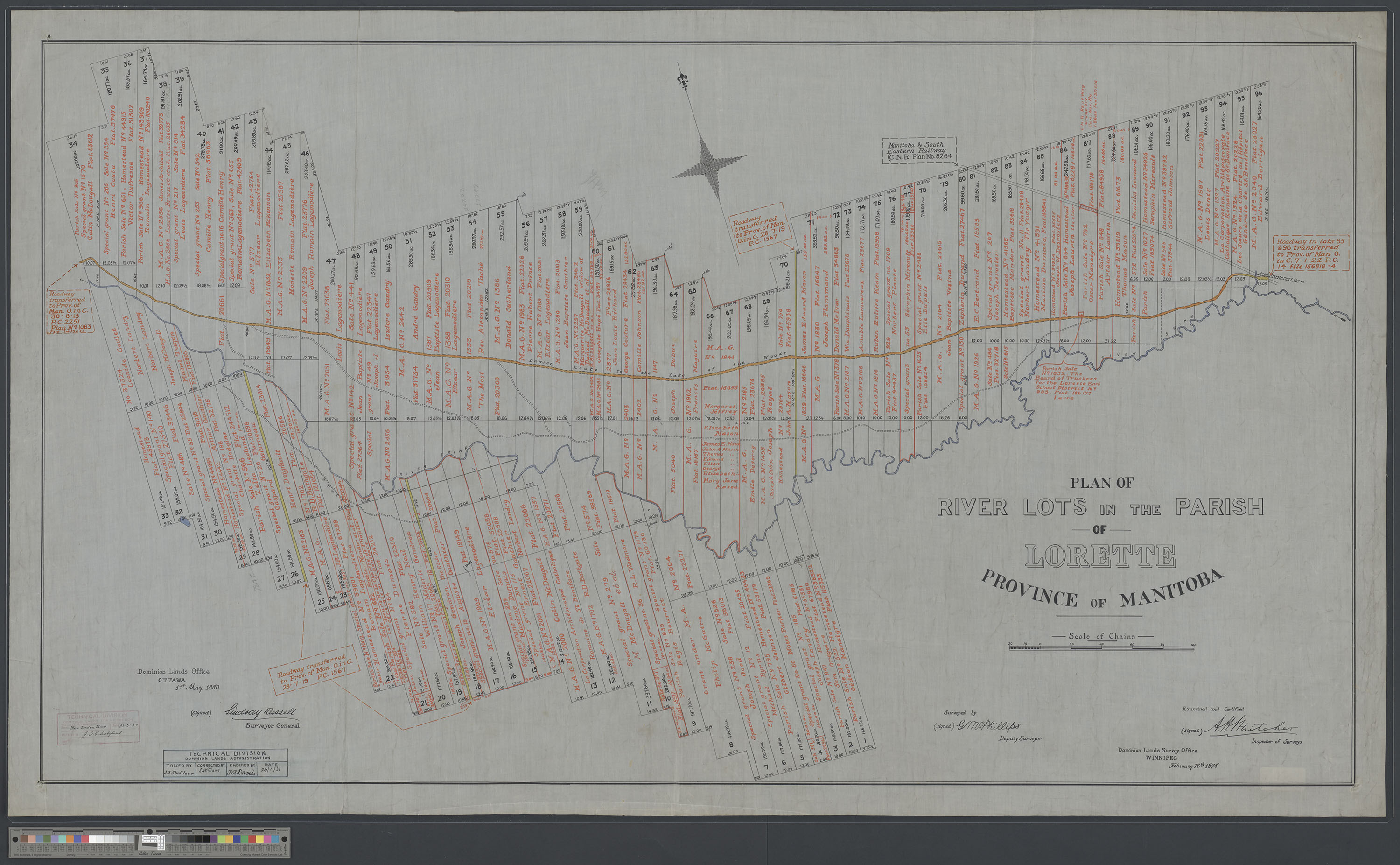
Plan of river lots in the Parish of Lorette, Province of Manitoba; surveyed by (signed) G. McPhillips, Deputy Surveyor; examined and certified by (signed) A.H. Whitcher, Inspector of Surveys; Dominion Lands Survey Office, Winnipeg, February 16, 1878 (e011213852)
