
By Andrew Elliott
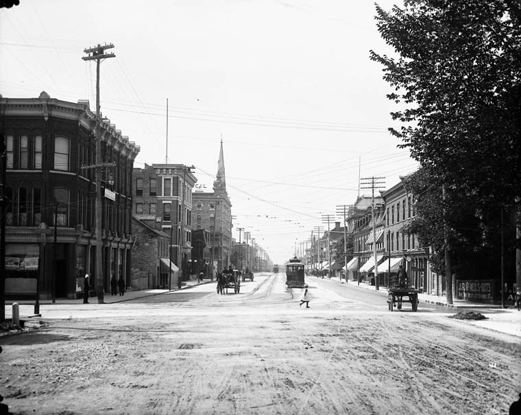
Wellington and Bank, ca. 1900 (MIKAN 3325940)
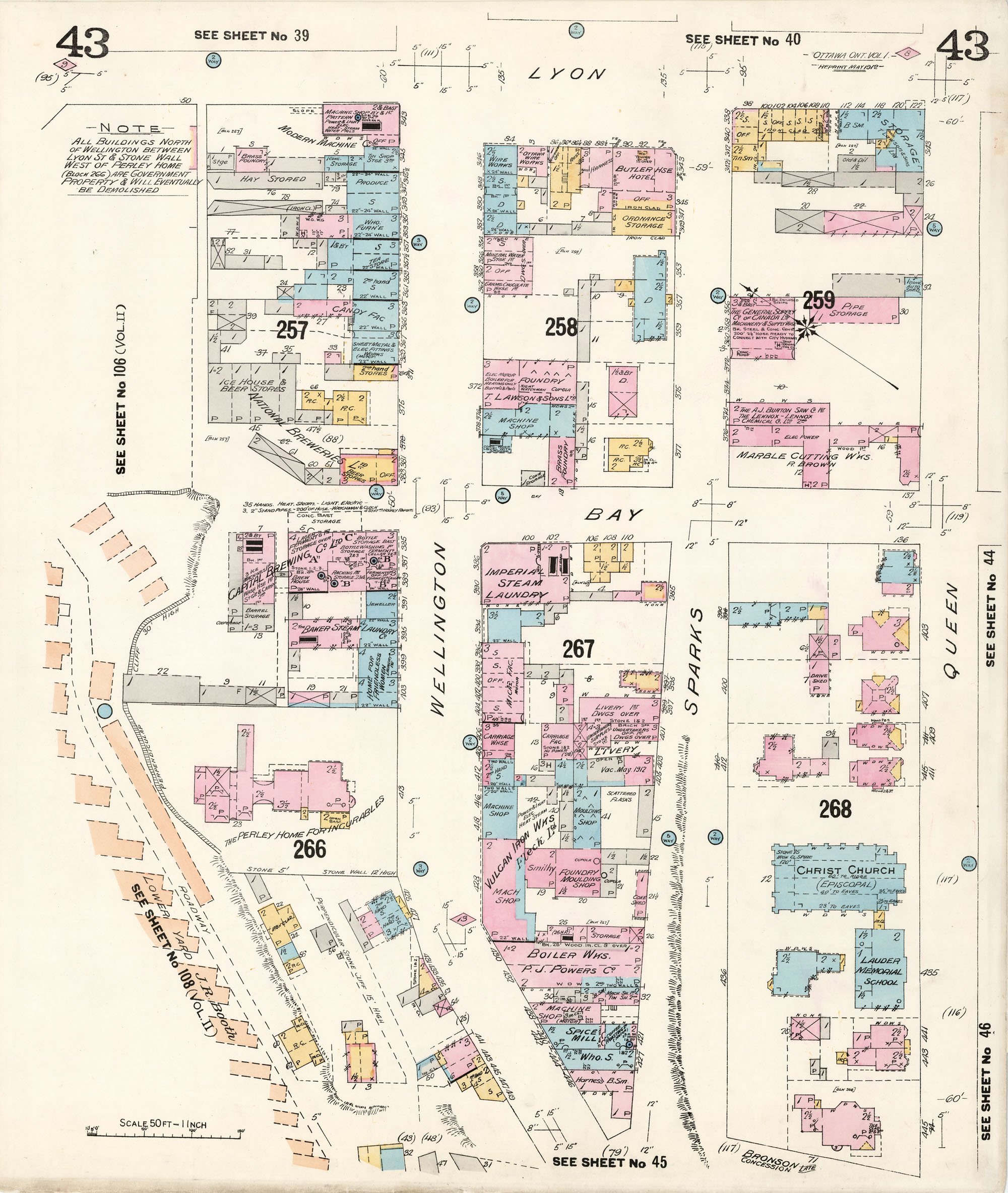
On February 27, 1912, following what appears to have been at least a few years of behind the scenes deliberations, the federal government expropriated all properties located in Uppertown, an area bounded by Bank, Wellington, and Bay streets and the cliff along the Ottawa River. On March 9, 1912, a notice of expropriation was filed at the Ottawa City Registry Office (the area can be seen on these fire insurance plans: east view and west view (MIKAN 3816030).
The area was expropriated to make way for a new supreme court and other federal buildings. In 1913, the government launched a design competition, in response to which many of the major architects of the day submitted designs for the building complex. The designs can be found in the following LAC collection, which comprises 11 designs for the location of proposed departmental buildings. With the outbreak of the First World War, the fire and subsequent reconstruction of the Parliament Buildings, and changes in government, no concrete action was taken with respect to these plans until the early 1930s.
The area expropriated was both commercial and residential in nature. We have come to think of the stretch of Wellington between Bank and Bay streets as a boulevard flanked by grand, iconic government structures and large green spaces, but this is a relatively recent development. The towers of the Confederation and Justice buildings were built in the 1930s, followed by the Supreme Court building and, finally, the National Library building (now Library and Archives Canada), which was erected for the 1967 centennial.
However, before 1900, here was a place where wealthy lumber barons rubbed shoulders with bankers and brewers, as well as lawyers, fur purveyors and politicians. In fact, three Fathers of Confederation—George-Étienne Cartier, Alexander Campbell, and J.C. Chapais—lived in the neighbourhood, as did Canada’s second prime minister, Alexander Mackenzie. Here there were mansions, including several of the finest homes in the city. There were also many establishments such as hotels, breweries and boarding houses, as well as shelters for homeless and socially disadvantaged persons.
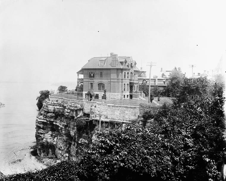
Residence of R. J. Devlin (41 Cliff Street), June 1894 (MIKAN 3422971)
On the current site of 395 Wellington, once stood the Perley Residence, the Home for Friendless Women, and the Capital Brewing Company.
An interesting exception, the Uppertown neighbourhood differed from other Ottawa neighbourhoods subsequently subjected to expropriations and mass demolitions in that most of these were largely working class areas. A short walk from both Parliament Hill and the industrial Chaudière District, Uppertown was a vibrant, mixed-class and mixed-use community.
In early spring 1912, a Department of Public Works photographer with an eye for detail went out and documented all the buildings in Uppertown.
Several photo albums in the Department of Public Works fonds (in accession 1959-084 NPC) have now been digitized. Thanks to these albums, we can now take a virtual walking tour of much of Uppertown. Here is a selection of the photos that have recently been digitized:
- Perley Residence
- Almonte House Hotel
- British Bank of North America (front and west facades)
- The McCarthy Building (front and west facade)
- Commercial Building, Wellington and Kent (front and side)
- Vandome Hotel, 287–289 Wellington and rear yard
Here are shots of other places on Vittoria and Kent Streets:
- Ottawa Curling Club, 96 Vittoria Street (back and front)
- Victoria Lawn Bowling Green (southeast corner Vittoria and Kent)
- John Manuel House, 34 Vittoria Street (front and west sides)
- The Gemmill House, 22 Vittoria Street
- The McCarthy House, 37 Kent Street
More digitized photos are available if you explore the 1959-084 NPC accession. Thanks to the photographic evidence, a lost Ottawa neighbourhood can be recreated for modern inhabitants with no memory of what was here before.
Andrew Elliott is an archivist in the Science, Environment and Economy Section of the Private Archives Division.
