
By Andrew Elliott
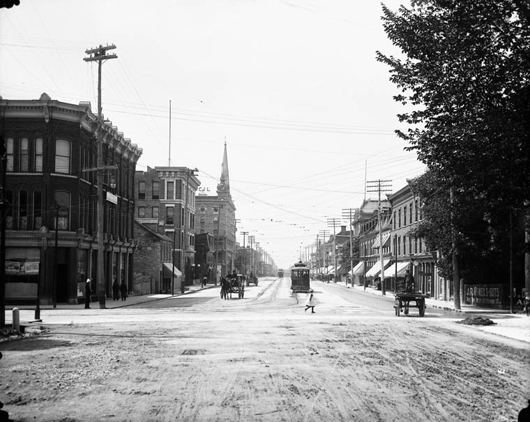
Wellington and Bank, ca. 1900 (MIKAN 3325940)
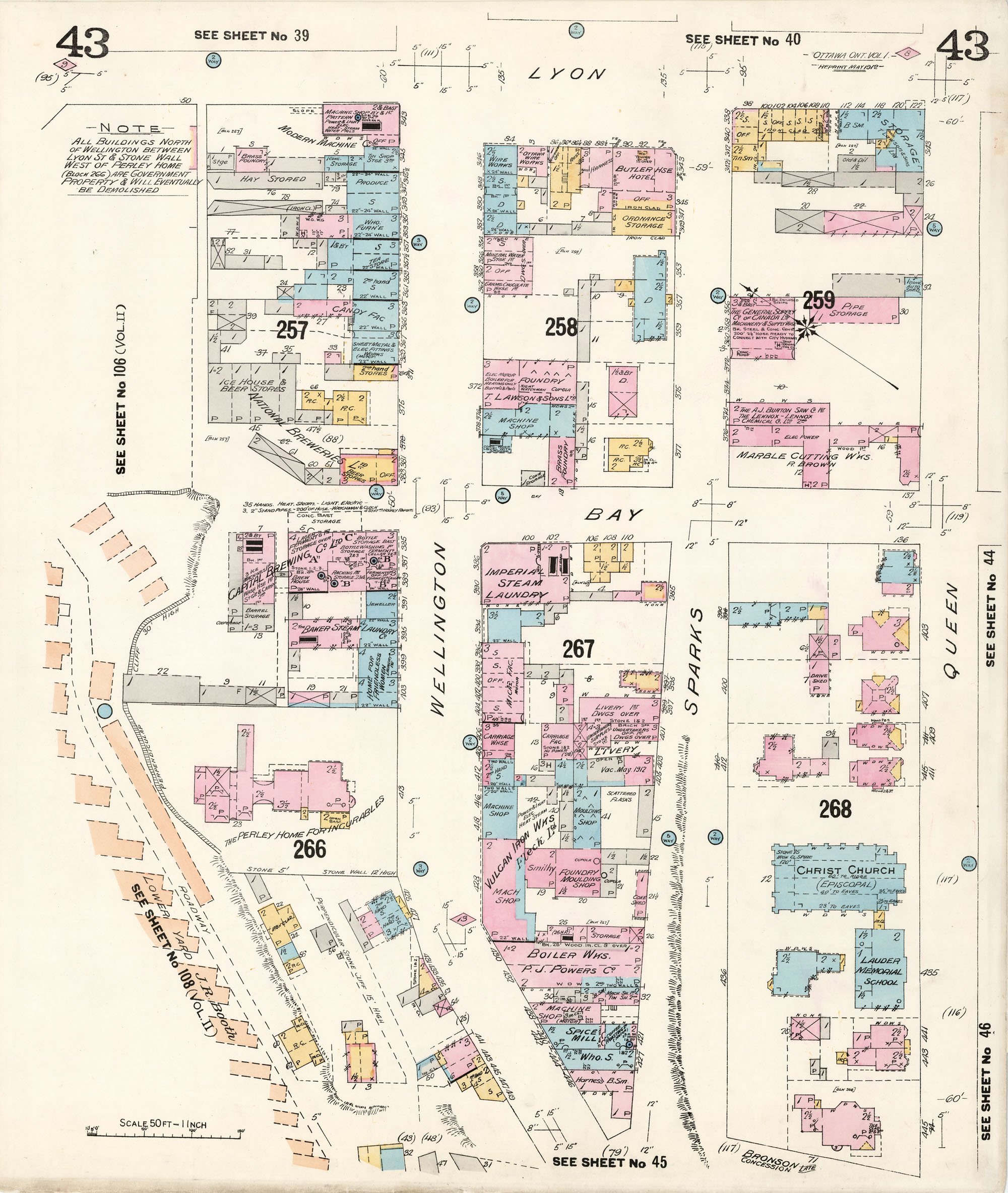
On February 27, 1912, following what appears to have been at least a few years of behind the scenes deliberations, the federal government expropriated all properties located in Uppertown, an area bounded by Bank, Wellington, and Bay streets and the cliff along the Ottawa River. On March 9, 1912, a notice of expropriation was filed at the Ottawa City Registry Office (the area can be seen on these fire insurance plans: east view and west view (MIKAN 3816030).
The area was expropriated to make way for a new supreme court and other federal buildings. In 1913, the government launched a design competition, in response to which many of the major architects of the day submitted designs for the building complex. The designs can be found in the following LAC collection, which comprises 11 designs for the location of proposed departmental buildings. With the outbreak of the First World War, the fire and subsequent reconstruction of the Parliament Buildings, and changes in government, no concrete action was taken with respect to these plans until the early 1930s.
The area expropriated was both commercial and residential in nature. We have come to think of the stretch of Wellington between Bank and Bay streets as a boulevard flanked by grand, iconic government structures and large green spaces, but this is a relatively recent development. The towers of the Confederation and Justice buildings were built in the 1930s, followed by the Supreme Court building and, finally, the National Library building (now Library and Archives Canada), which was erected for the 1967 centennial. Continue reading
