By Andrew Elliott
The year 2017 marks the 190th anniversary of the birth of Sir Sandford Fleming (1827–1915). Born in Kirkcaldy, Scotland, Fleming became a truly great Canadian. He was a successful surveyor, draftsman, and engineer. Among many accomplishments, he is noted for designing one of the first Canadian postage stamps, for helping to link Canada together by directing construction of the Canadian Pacific Railway, and for bringing international standard time to Canada and the world.
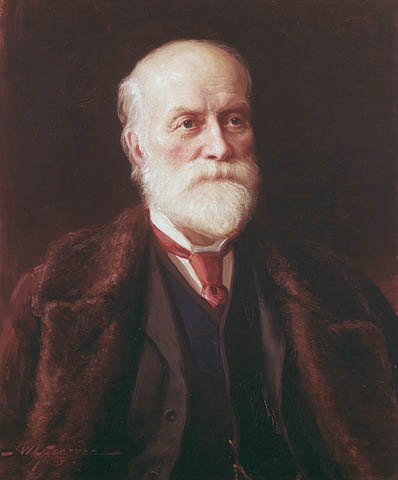
Sir Sandford Fleming, painted by John Wycliffe Lowes Forester, 1892 (MIKAN 2837695)
Like his British contemporary Charles Dickens, Fleming had an abundance of energy and productivity that would put a 21st-century individual to shame. Fleming recorded every aspect of his life, and was a great collector. He had a fine library and the walls of his house were covered with European art. Library and Archives Canada (LAC) is fortunate to hold the vast majority of records pertaining to Fleming’s life. It is a rich collection of text, photographs, and art, and has been with LAC since 1915.
After receiving an education in Kennoway and Kirkcaldy from the Scottish engineer and surveyor John Sang, Fleming immigrated to Canada from Scotland in 1845. To finish his certificate in engineering, Fleming prepared maps of Peterborough, Hamilton, Cobourg, and Toronto in 1849. After this, Fleming’s career took off.
In 1849, Fleming helped found the Royal Canadian Institute in Toronto, a professional society of architects, surveyors, and engineers. At the age of 30, in 1857, he was appointed engineer-in-chief of the Ontario Northern Railway.
Six years later, in 1863, the Canadian government appointed him chief surveyor of a proposed route for the Intercolonial Railway linking Upper Canada and Lower Canada to the Maritime colonies. He subsequently became chief engineer.
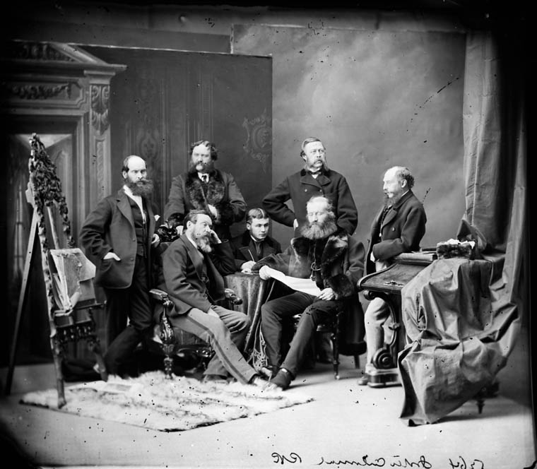
The Intercolonial Railway group with Sir Sandford Fleming seated on the right. Photograph by William James Topley, March 1870 (MIKAN 3378651)


![Les voyages du sieur de Champlain…, 1613 and its map Carte geographique de la Nouvelle Franse faictte par le sieur de Champlain [Geographical map of New France by Samuel de Champlain], engraved by David Pelletier in 1612. (MIKAN 3919638) (AMICUS 4700723)](https://thediscoverblog.com/wp-content/uploads/2017/01/15543654392_3ac964f9a1_k.jpg)