
![On the left of the graphic, Tatânga Mânî [Chief Walking Buffalo] [George McLean] in traditional regalia on horse. In the middle, Iggi and girl engaging in a “kunik”, a traditional greeting in Inuit culture. On the right, Maxime Marion, a Métis guide stands holding a rifle. In the background, there is a map of Upper and Lower Canada, and text from the Red River Settlement collection.](https://thediscoverblog.com/wp-content/uploads/2019/02/blog-banner-1.jpg)
By William Benoit
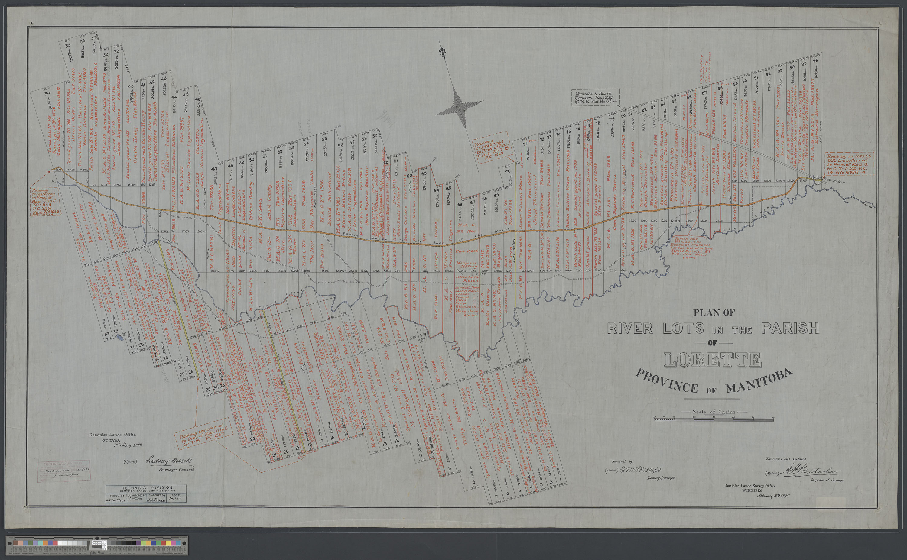
Library and Archives Canada holds plans produced by the Canadian government of existing Métis river lots. These were required by the Manitoba Act and the transfer of Rupert’s Land and the North-Western Territory. These river lot plans are important pieces in understanding the Métis Nation. The plans are invaluable to the entire Métis Nation because they show where many Métis ancestors lived before Canada’s acquisition of the region.
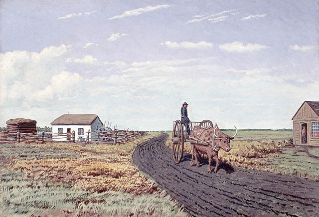
The Métis created settlements across the Métis Nation Homeland. The cradle of this homeland was the Red River Settlement. By 1869, there were 12,000 inhabitants there, of which 10,000 were Métis. Censuses recorded that 5,000 to 7,000 of the Métis were children.
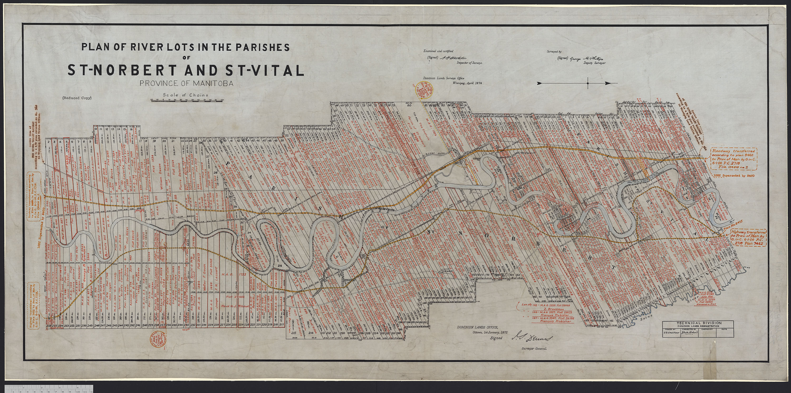
Visit the Flickr album for images of Métis Nation river lot plans.
