![On the left of the graphic, Tatânga Mânî [Chief Walking Buffalo] [George McLean] in traditional regalia on horse. In the middle, Iggi and girl engaging in a “kunik”, a traditional greeting in Inuit culture. On the right, Maxime Marion, a Métis guide stands holding a rifle. In the background, there is a map of Upper and Lower Canada, and text from the Red River Settlement collection.](https://thediscoverblog.com/wp-content/uploads/2019/02/blog-banner.jpg)
This article contains historical language and content that some may consider offensive, such as language used to refer to racial, ethnic and cultural groups. Please see our historical language advisory for more information.
By William Benoit
The year 2020 marks an important year in the history of Canada. One hundred and fifty years have gone by since the 1870 transfer of Rupert’s Land and the North-Western Territory to Canada. It is also the year that Manitoba entered Confederation. This was no small feat. There were discussions as to whether the Canadian government would create a province or just keep it as a vast territory.
The Métis would push Canada toward creating the new province.
Manitoba would be the first addition to the list of four original Canadian provinces: Ontario, Quebec, New Brunswick and Nova Scotia. There was no template to use. Deep, careful and altruistic thinking about the future should have been the order of the day. Instead, for the Métis, what resulted from the experience were feelings of displacement, trauma and resilience. In post-Confederation Manitoba, the position of the Métis deteriorated. New settlers from Ontario were hostile. Métis elders, over generations, described that period as a “Reign of Terror” against the Métis.
Métis Nation Elder Verna DeMontigny recently described the province-building exercise that led to Manitoba as a hard birth, or Kwaata-nihtaawakihk in the Michif language. It was certainly difficult.
The Supreme Court of Canada, in its 2013 decision in Manitoba Metis Federation Inc. v. Canada, provides a detailed narrative of the Métis people, the Red River Settlement, and the conflict that gave rise to the Manitoba Act and Manitoba’s entry into Canada:
The story begins with the Aboriginal peoples who inhabited what is now the province of Manitoba—the Cree and other less populous nations. In the late 17th century, European adventurers and explorers passed through. The lands were claimed nominally by England, which granted the Hudson’s Bay Company […] control over a vast territory called Rupert’s Land, which included modern Manitoba. Aboriginal peoples continued to occupy the territory. In addition to the original First Nations, a new Aboriginal group, the Métis, arose—people descended from early unions between European adventurers and traders, and Aboriginal women. In the early days, the descendants of English-speaking parents were referred to as half-breeds, while those with French roots were called Métis.
On November 19, 1869, the Hudson’s Bay Company surrendered Rupert’s Land and the North-Western Territory under its letters patent to the British Crown. By Order-in-Council dated June 23, 1870, the British government admitted these territories to Canada, under section 146 of the British North America Act, 1867 (now the Constitution Act, 1867), effective July 15, 1870.
It took almost eight months from the Hudson’s Bay Company surrender until the completed land transfer took full effect.
The Canadian government, led by Prime Minister John A. Macdonald, intended to absorb the territories and open them up to settlement. Before this could happen, Canada would need to deal with the Indigenous peoples who were living in these territories. Under the Royal Proclamation of 1763, Canada was duty-bound to treat with the sovereign Indigenous nations to obtain their consent to the Imperial Crown to exercise its sovereignty over them. Written more than a hundred years before, the proclamation’s purpose was to organize and manage the newly expanded British North American territories after the Seven Years’ War. Included in the proclamation were regulations to stabilize relations with Indigenous peoples through the regulation of trade, settlement and land purchases on the frontier.

The Manitoba Indian Treaty; a chief lecturing at length at the Stone Fort (the Métis man seated on a chair within the circle may be the translator) (e010967476)
Therefore, for the First Nations, the process would be to enter into treaties, whereby they agreed to settlement of their lands in exchange for reservations of land and other promises. The government policy with respect to the Métis was less clear.
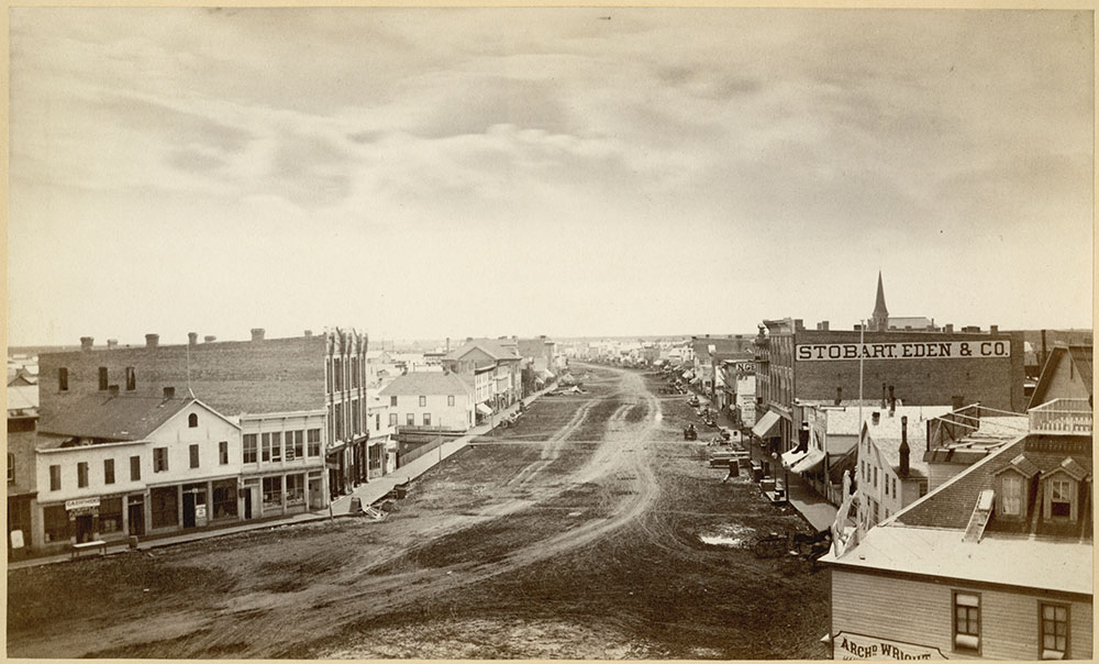
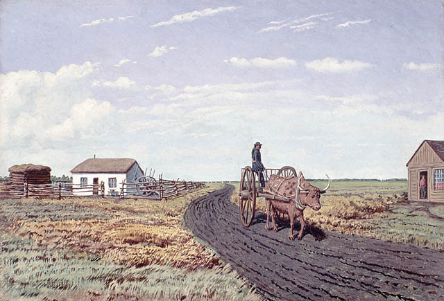
Main Street, Winnipeg, looking south, 1879; the street’s width was to accommodate the space needed for Red River Carts (e011156541)
Prior to confederation with Canada, white settlers had begun pouring into the Red River, displacing the social and political control of the Métis. This led to resistance and conflict. To settle the conflict and assure annexation of the territory, the Canadian government entered into negotiations with representatives of the Métis-led provisional government. The result was the adoption in 1870 of the Manitoba Act, which made Manitoba a province of Canada.
The Manitoba Act is a constitutional document with many treaty-like characteristics. It enshrines the promises and obligations that Canada has to the Métis people. These promises represent the terms under which the Métis agreed to surrender their claims to govern themselves and their territory, and to become part of Canada. These obligations remain in force today.
The Métis Nation is an internationally recognized Indigenous people. In Canada, it is one of three Indigenous groups with constitutionally entrenched Aboriginal and treaty rights, alongside First Nations (“Indians”) and Inuit (“Eskimos”). The Métis Nation Homeland is a vast area of land in west-central North America. The Métis, as the Founders of Manitoba in 1870 and Canada’s negotiating partners in Confederation, continue to play an important role in Canada’s development.
(In Michif: Li Michif Naasyoon nishtowinikaatew oobor lii piyii pi li moond nishtowiinikasowak li moond autochtone. Daan li Canada si te payyek enn band di moond avek lii dray tretii daan li constitution, aloon bor li Promii Naasyoon pi li Ziskimoo. Li Michif Naasyoon Nataal li piyii mitoni kihchi-mishow, li taryaen daan li sawntrel west Nor America. Lii Michif, koum li fondateur di Manitoba daan li 1870 pi Canada’s naasaasyi-iwow di maashkihtonikaywin daan li Confederation, kiiyapit il li enportaan daan li Canada’s oosishchikeywiin.)
William Benoit is the Advisor for Internal Indigenous Engagement in the Office of the Deputy Librarian and Archivist of Canada at Library and Archives Canada.

![On the left of the graphic, Tatânga Mânî [Chief Walking Buffalo] [George McLean] in traditional regalia on horse. In the middle, Iggi and girl engaging in a “kunik”, a traditional greeting in Inuit culture. On the right, Maxime Marion, a Métis guide stands holding a rifle. In the background, there is a map of Upper and Lower Canada, and text from the Red River Settlement collection.](https://thediscoverblog.com/wp-content/uploads/2019/02/blog-banner-1.jpg)