Frederick W. Waugh’s time in Nunatsiavut

On the left of the graphic, Tatânga Mânî [Chief Walking Buffalo] [George McLean] in traditional regalia on horse. In the middle, Iggi and girl engaging in a “kunik”, a traditional greeting in Inuit culture. On the right, Maxime Marion, a Métis guide stands holding a rifle. In the background, there is a map of Upper and Lower Canada, and text from the Red River Settlement collection.

This article contains historical language and content that some may consider offensive, such as language used to refer to racial, ethnic and cultural groups. Please see our historical language advisory for more information.

By Jennelle Doyle

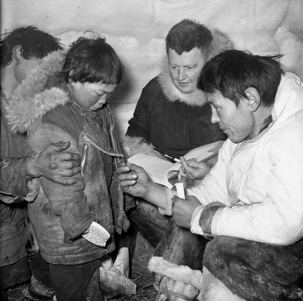
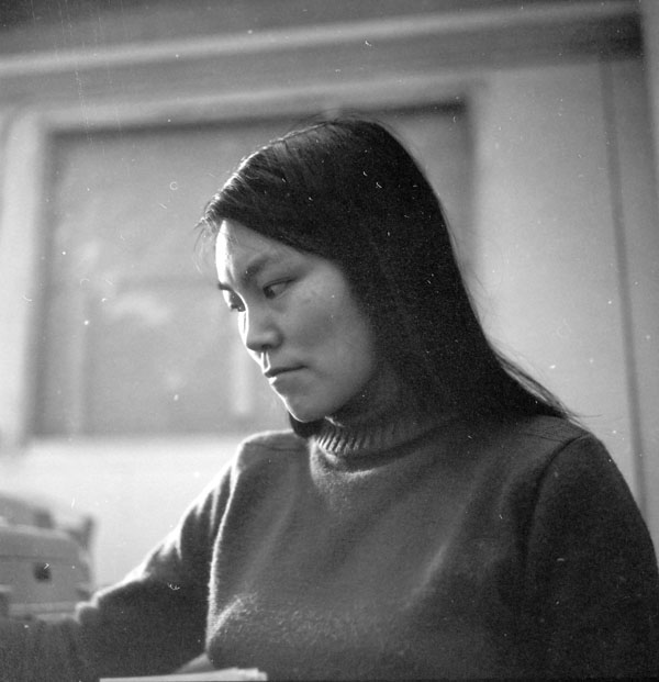
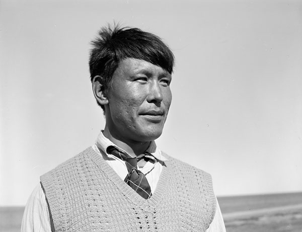
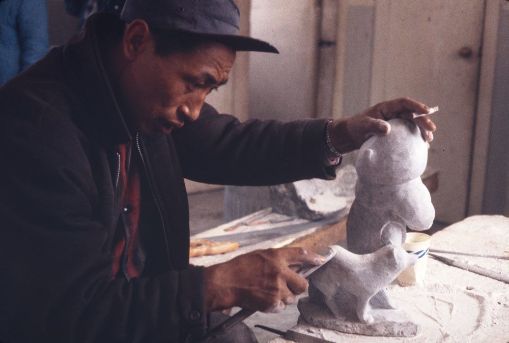
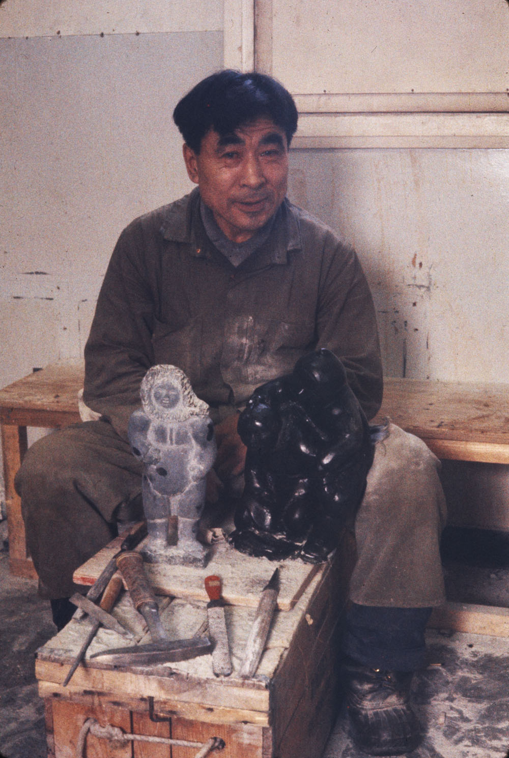
When searching an archive, all too often we find things in places where we would not ordinarily expect. The life journeys of explorers, researchers, anthropologists and other individuals who have donated material to an archive are integral to identifying the scope of a given collection. Frederick W. Waugh was an ethnologist who worked for a time with the Anthropology Division of the Geological Survey of Canada. His visit to the Inuit community of Nain in Nunatsiavut, the region of Inuit Nunangat situated in northern Labrador, in 1921–22 is reflected in a photo album his son R.F. Waugh donated to Library and Archives Canada (LAC).

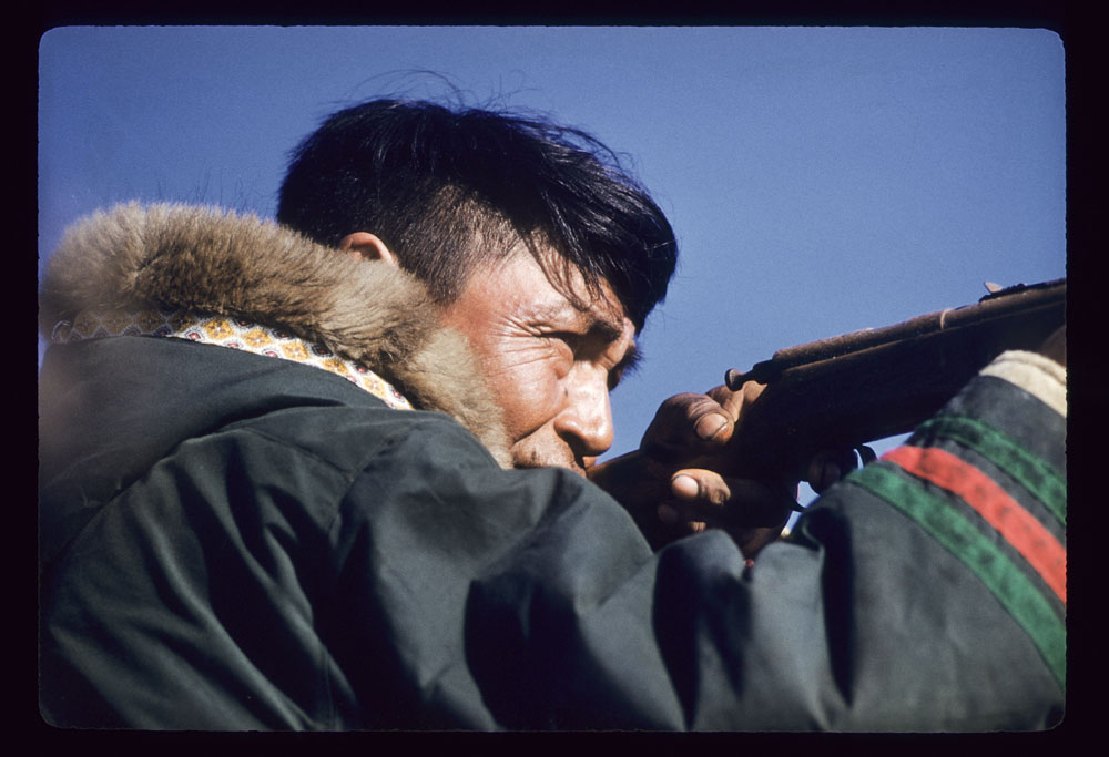
Frederick Waugh had set out for Labrador in 1921, noting in his journal his intent to photograph and study Montagnais people (now Innu Nation [Naskapi–Montagnais]). However, Waugh ended up at Nain and primarily photographed and documented Inuit who lived in that area. His photographs, in an album at LAC, provide a glimpse into the everyday life of Nainimiut: dogsledding, gathering driftwood, skinning seals, ice fishing and more.

A black and white photograph of three men standing around a group of sled dogs, who are eating. There is a white building in the background.

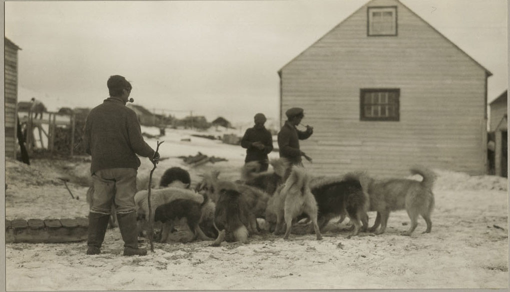
Three Inuit men feeding sled dogs (e011369232-025)

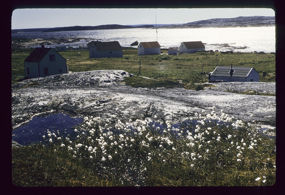
The album captures an interesting time in the community. In Nunatsiavut, Moravian ties are strong and many Nunatsiavummiut (Inuit of Nunatsiavut) still follow Moravian practices. German-speaking Moravian missionaries from Europe began settling in Labrador in the late 1700s. They established eight missions along the coast, one of which was Nain in 1771. In 1921, the Moravian church in Nain burned down. Waugh’s photographs captured the early efforts to rebuild the church using debris from the original structure (pictured here). The Memorial University Archives has images of the Moravian church before the fire, as well as other photographs of Nain in this period.

A black and white photograph of the ruins of a building with snow-covered items scattered around.

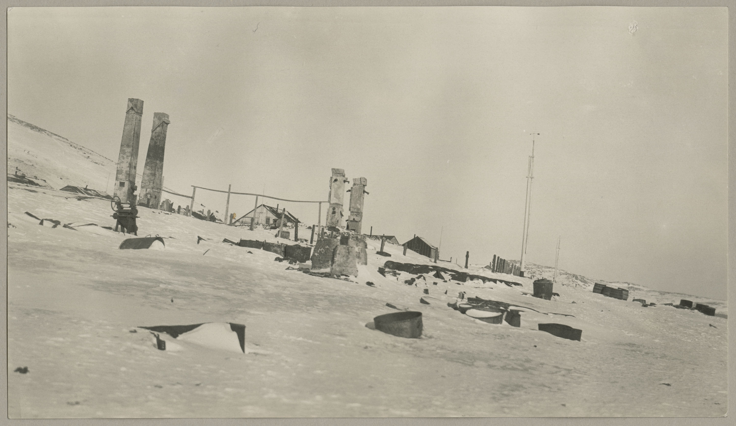
Ruins of Nain’s Moravian Mission, which burned in the fall of 1921, Nunatsiavut. Photo Credit: Waugh (e011369232-018)

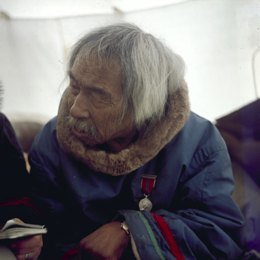
The Canadian Museum of History houses copies of similar photographs, as well as Waugh’s journals. His journals from this period were titled “Labrador Eskimo Notes.” These journals provide a detailed account of various medicines, games, hunting practices, food knowledge and customs. As noted in his journals from Labrador, one of his most frequent sources was Amos Voisey.

A black and white photograph of four boys in parkas looking towards the camera. There are two buildings in the background.

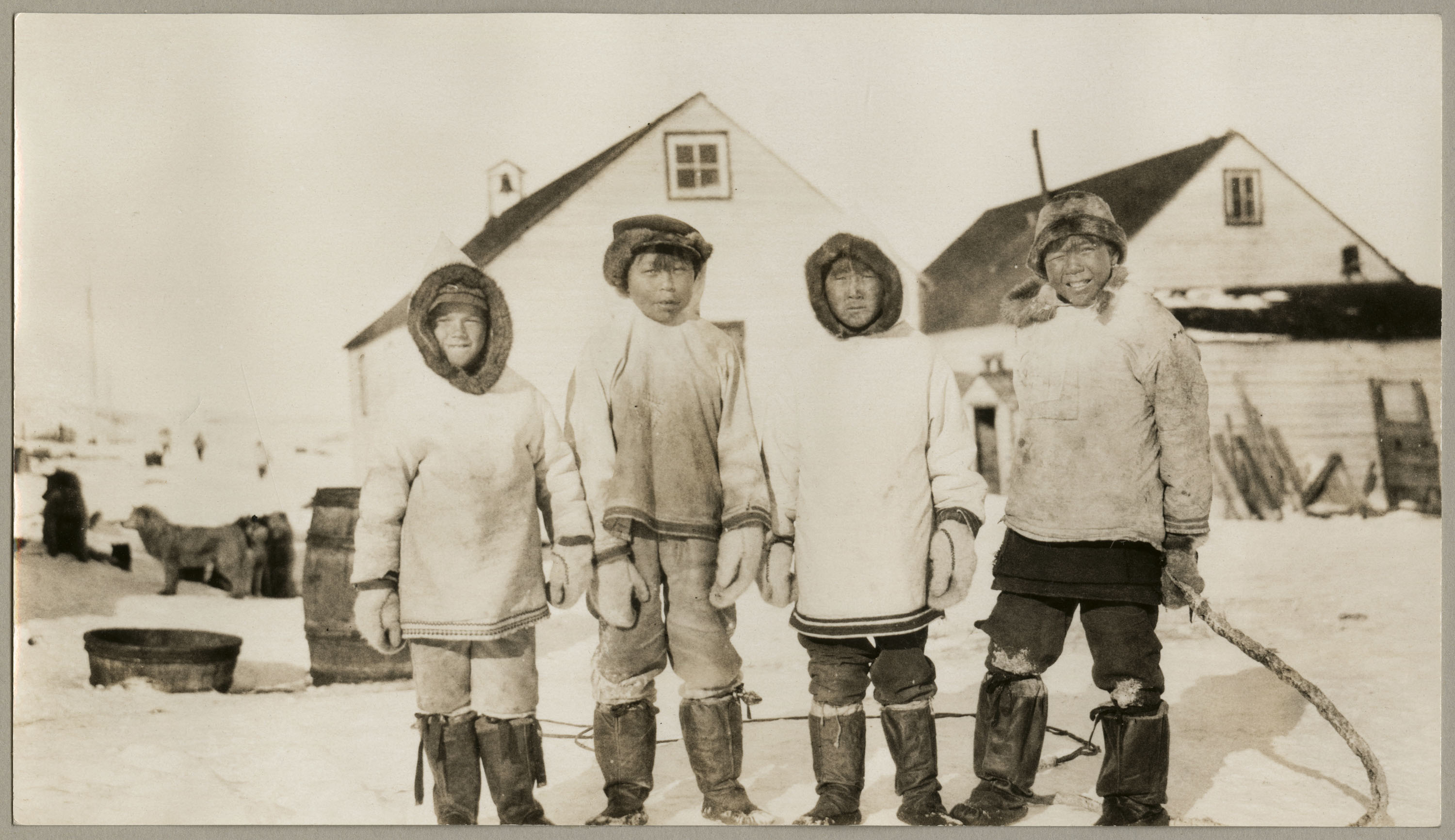
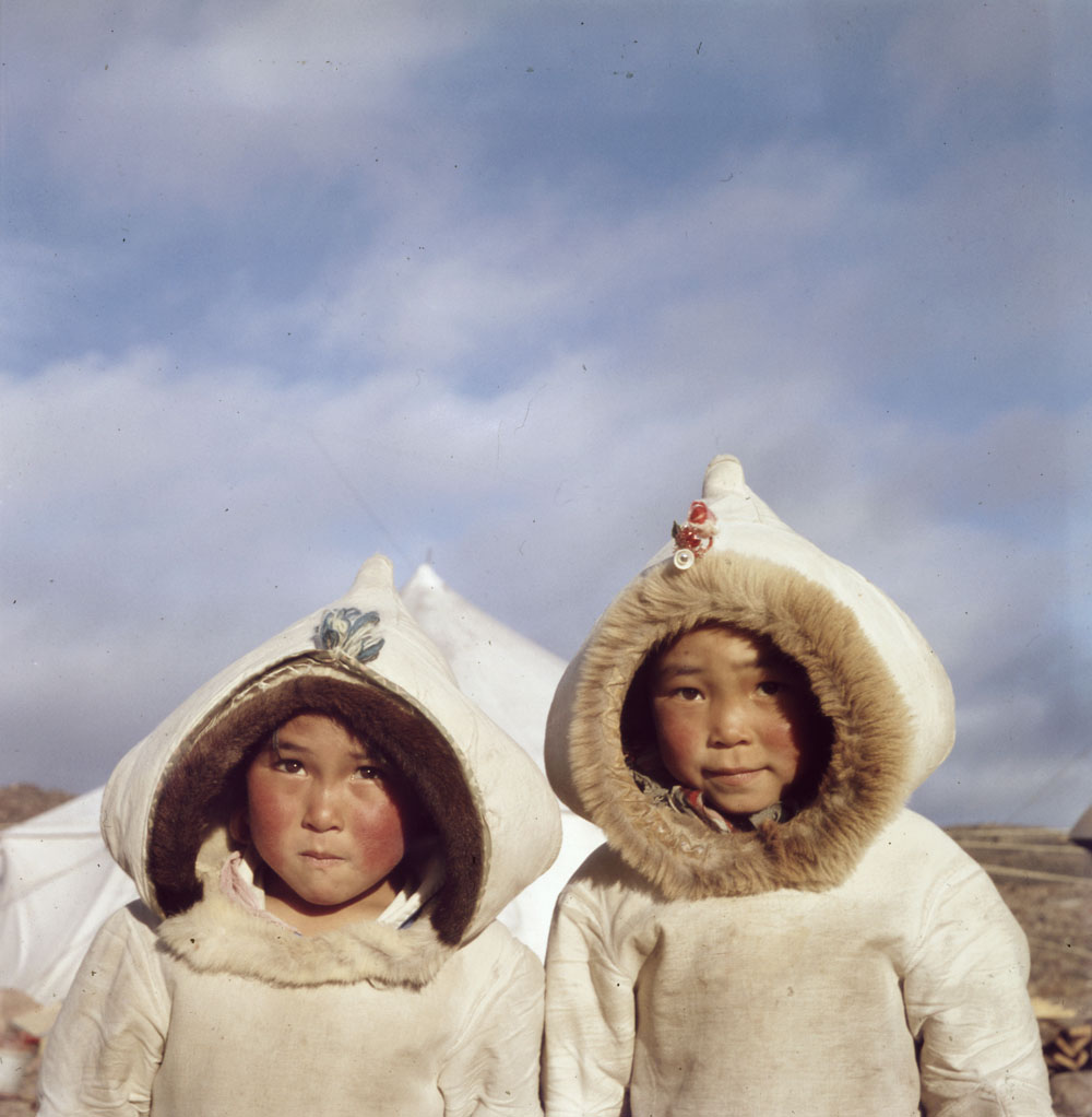
Four boys in parkas and black-bottom kamek (sealskin boots) (e011369232-009)

Archives can sometimes be tangled webs that are difficult to navigate. I hope that by highlighting this album, it will help connect some of the dots for others who are interested in content relating to Nain, or Fredrik W. Waugh himself. Some of the names of those pictured in the photos may be inaccurate. We encourage you to reach out if you have any additional information that could help us create a more accurate record.

All in all, these beautiful photographs speak for themselves.

If you are interested in Nain, Nunatsiavut and the Nunatsiavummiut, visit Heather Campbell’s blog about Judith Pauline White.

This blog is part of a series related to the Indigenous Documentary Heritage Initiatives. Learn how Library and Archives Canada (LAC) increases access to First Nations, Inuit and Métis Nation collections and supports communities in the preservation of Indigenous language recordings.


Jennelle Doyle is an archivist with the Listen, Hear Our Voices initiative at Library and Archives Canada. Jennelle grew up in Churchill Falls, Labrador, her family being from both the south coast of Labrador and the island of Newfoundland. She has been located in Ottawa since 2019 and is currently a master’s student at the University of Ottawa while continuing her work on the initiative.

Charles Gimpel and the Canadian Arctic: 1958–1968

On the left of the graphic, Tatânga Mânî [Chief Walking Buffalo] [George McLean] in traditional regalia on horse. In the middle, Iggi and girl engaging in a “kunik”, a traditional greeting in Inuit culture. On the right, Maxime Marion, a Métis guide stands holding a rifle. In the background, there is a map of Upper and Lower Canada, and text from the Red River Settlement collection.

This article contains historical language and content that some may consider offensive, such as language used to refer to racial, ethnic and cultural groups. Please see our historical language advisory for more information.

By Miranda Virginillo

Charles Gimpel was an English photographer and art collector who travelled in the Canadian Arctic many times between 1958 and 1968, capturing moments of Inuit life. In 1958, the Hudson’s Bay Company (HBC) funded Gimpel’s trip from Winnipeg to Churchill, Manitoba, and to various ports around the Foxe Basin and northern Hudson Bay. In return, the HBC received photographs of their stores and the products in use in Kangiqliniq (Rankin Inlet), Igluligaarjuk (Chesterfield Inlet), Pangnirtung and other locations. The Department of Northern Affairs and Natural Resources Canada funded subsequent trips to the Arctic, in varying degrees. Gimpel’s patrons largely determined his activities in what was then part of the Northwest Territories (present-day Nunavut). Gimpel’s correspondence, articles, journals, notebooks and large number of slides in the Charles Gimpel fonds chronicle the beginning of an era of artistic production in the Canadian Arctic. The notebooks from his first trip in 1958 are particularly specific about his activities and demonstrate who and what would influence the rest of his career. Gimpel’s notebooks and photographs detail the places he travelled, the people he encountered and the conversations he had with them.

Colour photograph of an Inuk man, Kove, and Charles Gimpel dressed in brown-and-white fur parkas. The photo is very hazy because of a snowstorm.

Charles Gimpel (right), whose Inuit nickname was Ukjuk, with friend and guide Kove in a snowstorm near Inuksugalait (Inuksuk Point, Enukso Point), possibly Kinngait (Cape Dorset), May 1968 (e011212607)

My job as a Carleton University practicum student was to record the details of the places where Gimpel went and the people he met during his travels, to decipher his notebooks written in a personal shorthand, and to determine the location of a hand-drawn map. The first task was no small feat. The trip between Winnipeg and Churchill took five days by train, and Gimpel was interested in the stories of everyone he encountered on the journey. During his first trip alone, Gimpel recorded varying levels of information for approximately 40 named people, and for many more who were unidentified.

In deciphering Gimpel’s notebooks, the code followed the same pattern throughout: date, location, film conditions, subjects and, noted later, the four-digit identifier for the film roll in his collection. For example, “6241” indicated roll 41, taken in 1962.

The map refers to an arrangement of inuksuit (plural for inuksuk) at Inuksugalait (Inuksuk Point, Enukso Point). Inuksuit are cairns to mark a place for others or oneself. They serve many purposes, from being navigational aids to communicating good fishing spots or food caches. Gimpel recorded the height of each inuksuk and the distances between them, measured in feet. He also laid “claim” to the inuksuit by naming them after his friends and companions. The shorter inuksuit were named after children he had met on his trip: Nuvuolia (Nuvuoliak, Nuvoalia) and his adopted brother Irhalook, and Kove’s son Iali. The larger inuksuit were named after his interpreters, Pingwartok and Johanessie, and the sculptor Tunu. Gimpel even went so far as to give one inuksuk his own Inuit nickname, Ukjuk, which means bearded seal.

Hand-drawn map on white paper in a spiral notebook. The map consists of red circles with black lines between them, names of the inuksuit, numbers in brackets and a compass indicating East, South, West and North.

Map of inuksuit at Inuksuk Point, page 10 of document, 1964 (e011307430)

At the end of his 1958 journal, Gimpel recorded his meeting with James (Jim) Houston. This introduction solidified Gimpel’s interest in the Canadian Arctic for the rest of his life. Over the next decade, both men coordinated their efforts with Terry Ryan of the West Baffin Island Eskimo Cooperative (WBIEC) and the heads of other co-operatives in the Arctic to help develop this source of income for Inuit. Gimpel provided international venues, including the Gimpel Fils art gallery in London, the Smithsonian Institution in Washington, D.C., and the Bezalel National Museum in Jerusalem, with art from Kinngait (Cape Dorset), Iqaluit (formerly Frobisher Bay) and nearby camps. Photographs from his 1964 and 1968 trips capture stone carvers at work in Iqaluit and at the WBIEC.

A colour photograph of an Inuk man wearing a dark jacket and cap as he carves white statues.

Henry Evaluardjuk carving, Iqaluit, April 1964 (e011212063)

A colour photograph of an Inuk man sitting behind a stone sculpture with his tools in front of it.

Unidentified sculptor, Iqaluit, April 1964 (e011212065)

Gimpel’s trips were taken at a time when many people from southern Canada and abroad were discovering the unique Inuit art and culture. His journals and the photographs he took during his trips to the Arctic are now available online. The Rosemary Gilliat Eaton fonds, the James Houston fonds and the Canadian Eskimo Arts Council series in the Department of Indian Affairs and Northern Development fonds also reflect this pivotal time in history.

This blog is part of a series related to the Indigenous Documentary Heritage Initiatives. Learn how Library and Archives Canada (LAC) increases access to First Nations, Inuit and Métis Nation collections and supports communities in the preservation of Indigenous language recordings.


Miranda Virginillo, from the School of Art and Culture at Carleton University, is an undergraduate practicum student in the Public Services Branch at Library and Archives Canada.

Qimmiit (sled dogs)

On the left of the graphic, Tatânga Mânî [Chief Walking Buffalo] [George McLean] in traditional regalia on horse. In the middle, Iggi and girl engaging in a “kunik”, a traditional greeting in Inuit culture. On the right, Maxime Marion, a Métis guide stands holding a rifle. In the background, there is a map of Upper and Lower Canada, and text from the Red River Settlement collection.By Laura Johnston

Traditionally, qimmiit (sled dogs) were an important part of Inuit culture. They represented a way of life and a connection to the land. Qimmiit were especially useful in transportation, safety and hunting. Today, however, the relationship between Inuit and qimmiit has changed, in part because of permanent settlement and a massive decline in the qimmiit population. Qimmiit have become more of a symbol or a connection to the cultural past.

Black-and-white photo of a team of sled dogs pulling a sled across an expanse of snow.

Qimuksiqtut (dog team with more than one person), Kugluktuk, Nunavut (formerly Coppermine, Northwest Territories), 1949 (a129937)

A black-and-white photo of a sled dog jumping across an opening of water, while a man holds its reins.

Phillip Napacherkadiak and his Qimuksiqtuq (dog team with one driver), Taloyoak, Nunavut (formerly Spence Bay, Northwest Territories), 1949–1950 (a129590)

Before the snowmobile was introduced to the North in the 1960s, going by qimuksiqtuq (dog team) was the primary means of transportation to travel across the frozen land and sea. Even after the introduction of the snowmobile, some preferred qimmiit as a way to travel. In contrast to the noise of snowmobiles, travelling by qimuksiqtuq was more pleasant and peaceful.

A black-and-white photo of a sled dog resting on the snow.

Qimmiq (sled dog) resting during a trip from Moose Factory Island, Ontario, to Kuujjuarapik, (formerly Great Whale), Quebec, 1946 (e010692583)

Travelling by qimuksiqtuq offered other benefits, including safety and protection. On account of their acute senses, qimmiit were useful for their ability to find their way home, or even a temporary camp, if a traveller were caught in a blizzard or a whiteout. Qimmiit were also useful to Inuit for travelling safely over ice. They were better able to sense whether the ice was too thin, and were usually able to avoid such areas. Qimmiit could also spread out and disperse their weight when travelling over thinner ice, making it less likely for a sled to fall through. However, even if a qimmiq (a single dog) fell through the ice, not every dog—or the traveler—would necessarily be endangered.

A black-and-white photo of a man holding a sled dog. The sled dog is wearing booties.

Possibly Ulaajuk and his qimmiq, Taloyoak, Nunavut (formerly Spence Bay, Northwest Territories) (a114721)

Qimmiit offered safety to Inuit in another way: from the threat of polar bears. Polar bears can be aggressive toward humans; they can pose a real danger to Inuit communities, especially travellers. Qimmiit were ideal protection, as they could warn people about bears entering a camp. Even without training, qimmiit would instinctively fight off polar bears. Consequently, Inuit travellers were able to sleep in peace and without fear when out on the land.

A black-and-white photo of some people pulling a seal, which they have just hunted, out of a hole in the ice. A sled dog team is in the background.

From left to right, Aqaatsiaq, Ipeelie Inuksuk, Felix Alaralak and Uqaliq, and their qimuksiqtut (dog team), Iglulik, Nunavut (formerly Igloolik, Northwest Territories) (a146059)

In additional to protection and safety, qimmiit played an important role in assisting Inuit in seal hunting. Hunting has traditionally been a defining element of Inuit life and culture. While the dogs were not necessarily trained to hunt, Inuit relied on the keen sense of smell of qimmiit to sniff out the locations of breathing holes and seals.

A black-and-white photo of a man with a dog.

Unidentified Inuk with his qimmiq, Kugluktuk, Nunavut (formerly Coppermine, Northwest Territories) (a146586)

Transportation, safety and assistance in hunting were all ways that qimmiit traditionally aided life in the Arctic. However, the enforced settlement of Inuit into permanent communities, and the dog slaughter during the 1950s and 1960s, resulted in a massive decline in the dog population. For more information on the slaughter, visit the Qikiqtani Truth Commission. In August 2011, the Quebec government offered an official apology for the negative effects on Inuit society of the mass slaughter of sled dogs in Nunavik (northern Quebec). This decline across the North created a profound shift in the relationship of Inuit with qimmiit. Today, qimmiit are mainly used for racing, which is a demanding and challenging sport. Dog racing has since become a celebrated new tradition in many Inuit communities.

A colour photo of two men with a team of sled dogs pulling a sled up a hill.

Qimuksiqtut at “Innukshuk” historical site, located either on the Foxe Peninsula, Baffin Island or Inukshuk Point (also spelled Enukso Point), Nunavut, 1958–1966. Photo by Charles Gimpel (e011211980)

This blog is part of a series related to the Indigenous Documentary Heritage Initiatives. Learn how Library and Archives Canada (LAC) increases access to First Nations, Inuit and Métis Nation content and supports communities in the preservation of Indigenous language recordings.


Laura Johnston, from the School of Art and Culture at Carleton University, is an undergraduate practicum student in the Public Services Branch at Library and Archives Canada.

The mystery of the Franklin expedition

By Catherine Butler

The lost expedition

The story of the lost Franklin expedition is well known to many Canadians. Led by Sir John Franklin, the expedition comprised 24 officers and 110 men and set sail from Greenhithe, England, in May 1845 in search of the Northwest Passage. On board the HMS Terror and the HMS Erebus, the voyage initially progressed relatively smoothly.

The crew made it to the Whale Fish Islands off the coast of Greenland to stock up on supplies, and arrived in Baffin Bay in July 1845. There, the captains of two whaling ships, the Prince of Wales and the Enterprise, saw the crew while waiting for favourable conditions to cross Lancaster Sound. This was the last time they were ever seen.

What happened next is as horrifying as it is legendary. The crews of the Erebus and Terror spent the winter of 1845–1846 on Beechey Island, where three crew members died and were buried. Things would only get worse from there. In September 1846, the ships got stuck in ice off the coast of King William Island, where they remained for the winter and spring of 1847. By June 1847, Sir John Franklin was dead. The remaining crew, now captained by Francis Crozier, spent the rest of 1847 stuck in the ice, unable to continue their voyage.

By April 1848, the Erebus and the Terror were abandoned and the remaining crew set off on foot for the mainland. All the men perished along the way, and it would be years before anyone would learn of their fate.

Unlocking the mystery

In the years immediately following the expedition, when no word from the crew was received, the British government made efforts to locate the men, offering rewards for information about their whereabouts or their discovery. The first mission dispatched to search for the Franklin expedition set off in 1848. The mission failed. No sign of the lost men emerged until 1850, with the discovery of their winter camp at Cape Riley and the graves of the men who died during the first winter on Beechey Island.

Poster offering a £20,000 reward for the discovery of the Franklin expedition.
£20,000 reward for the discovery of the missing Franklin expedition, March 7, 1850 (e010754422)

During an 1854 expedition sponsored by the Hudson’s Bay Company, John Rae arrived in the Boothia Peninsula, where he met an Inuit man who told him of a group of white men who had starved to death a few years earlier at the mouth of a large river. After speaking with a number of other Inuit people from the area, Rae was able to identify the Back River as the likely site of the sighting. During this voyage, Rae acquired a number of relics belonging to the lost expedition, including inscribed silverware.

Drawing of a number of different items recovered during various search operations dispatched by the British government to locate the lost Franklin expeditions. Items include silverware, blades, pocket-watches, knives and flasks.
Relics of the Franklin expedition, ca. 1845 (e010958396)

Throughout the years, numerous expeditions sought to locate the lost ships and recover the bodies of the crew. RCMP patrols, intrepid travellers and archeologists attempted to uncover the fate of the men and to locate the abandoned ships. Graves, skulls and countless artifacts were located, but the ships remained hidden. Crews would search for ships, but it would take nearly 170 years for them be found.

Black-and-white photograph depicting 5 skulls against black rocks. The skulls were found in 1945 during an expedition by William Skinner and Paddy Gibson.
Skulls of members of the Franklin expedition discovered and buried by William Skinner and Paddy Gibson in 1945 (a147732)

Uncovered at last

In 2008, the Canadian government launched a renewed effort to locate the wreckage of the Franklin expedition’s lost ships. Working more closely with Inuit historians and local communities, these efforts would soon pay off. In September 2014, the HMS Erebus was discovered near King William Island in the Queen Maud Gulf. Locating this ship, which had eluded so many experts for so many years, was made possible largely because of the oral histories known to historian Louie Kamookak.

Almost exactly two years later, the wreckage of the HMS Terror was located, thanks in large part to Sammy Kogvik, an Inuit hunter and Canadian ranger who joined the crew of the Arctic Research Foundation that lead search and recovery efforts. Without the assistance and knowledge of local Inuit communities, it is quite possible that the abandoned ships might never have been located.

Find out more

Library and Archives Canada holds a number of archival records relating to the search for the lost expedition, including journals kept by Francis McClintock during his four Arctic expeditions in search of Sir John Franklin between 1848 and 1859.

For more information on the importance of oral histories and Inuit knowledge, David Woodman’s Unravelling the Franklin Mystery: Inuit Testimony is an excellent source (OCLC 897576712)


Catherine Butler is a Reference Archivist in the Public Services Branch at Library and Archives Canada.

Rosemary Gilliat’s Arctic Diary

By Katie Kendall

In June 1960, photographer Rosemary Gilliat (later known as Rosemary Gilliat Eaton), along with journalist Barbara Hinds, travelled across the Arctic. Northern Affairs Canada and the National Film Board of Canada sponsored her journey. Her assignment in Iqaluit (formerly Frobisher Bay, Nunavut), Kuujjuag (formerly Fort Chimo, Quebec), Kangiqsualujjuag (formerly George River, Quebec), Killiniq (formerly Port Burwell, Nunavut), and Cape Dorset (Nunavut), was to take photographs of life in the north. During this period, Gilliat kept an extensive diary of her travels, describing the people, places, ways of life, events, and even the flora and fauna she encountered.

A colour photograph of two women fishing on the banks of a water body. They are standing on rocks and there are ice floes in the water.

Rosemary Gilliat (L) and Barbara Hinds (R) fishing (MIKAN 4731485)

As a practicum student at Library and Archives Canada (LAC) this term, I read the diary in full, taking note of important dates, people, places, and events. This will help improve the archival descriptions of Gilliat’s photographs in LAC’s collection. Many of the photos taken by Gilliat during this trip have been included as part of Project Naming, a LAC initiative that enables Indigenous peoples to engage in identifying the people, places, and activities in historical photos. Gilliat’s 455-page diary and many of her photos from the Arctic will be available for the public to help transcribe, tag and describe in our new and upcoming tool Co-Lab!

A colour photograph of two Inuit children wearing traditional coats in front of a white tent in a rocky landscape.

Two children wearing white parkas in the Arctic (MIKAN 4324336)

Gilliat’s diary describes many fascinating aspects of the Arctic in the summer of 1960, reflected in the almost-daily entries. Gilliat describes the landscape of the north in spectacular detail, and particularly focuses on the Arctic flowers at the start of her travels, when she had not yet made many acquaintances. Her occasional frustration with friend and travel companion Hinds is relatable, and her frequent photographic mishaps (for example, forgetting to carry film) are amusing. The snippets of news from the outside world provide the reader with a glimpse of life at that time. For example, Gilliat receives news about the ongoing space race—Russian dogs Belka and Strelka successfully orbit the Earth and return from space in August 1960—prompting Gilliat to muse on when the world will see the first human in space, which would happen less than a year later in April 1961. Gilliat also takes note of women’s roles in the north, referencing the second wave women’s movement of the 1960s.

A colour photograph of a community of wooden houses on the shores of a water body. There are flowers in the foreground.

Landscape view of wooden houses by the water (MIKAN 4731543)

Most importantly, Gilliat shares experiences with the Inuit of the communities she visits, accompanying members of the community while they fish for char, hunt for seals, and travel from one location to the next by boat or plane. Gilliat had a couple of near-death experiences travelling by boat through storms and ice, and was stranded a couple of times (once on an island for several days). In late August, she witnessed a beautiful polar bear swimming, only to realize that Eetuk, Isa, Sarpinak and Moshah, her Inuit companions, were going to kill it to provide food for their people. Gilliat’s expressive writing vividly explains her conflicting feelings on the event.

A colour photograph of a man seen in profile aiming a gun. He’s wearing a traditional fur-trimmed parka with alternating green and red stripes on the sleeves.

Oshaneetuk, a sculptor and hunter, on a seal hunt, Cape Dorset, Nunavut (MIKAN 4731420)

The hunting expeditions and tumultuous sailing events are thrilling, but the quiet moments between Gilliat and Inuit friends stand out. For example, in Cape Dorset, she meets Kingwatsiak, one of the oldest and most respected members of the community. Kingwatsiak invites Gilliat into his home and asks her to take a photograph of him. He also asks her to write a request on his behalf to Queen Elizabeth II. Kingwatsiak wishes for a photograph of her younger son, Prince Andrew, as his name (in English) is also Andrew. The letter is included in the diaries, and explains that he received a medal at the Queen’s coronation and travelled to Scotland as a young man and attended Queen Victoria’s Jubilee. He asks the Queen to deliver the photograph soon, as “I am now a very old man” and therefore may not have much time left.

A colour photograph of an elder wearing a traditional coat with green and red stripes on the sleeves. He is also wearing a medal with an image of Queen Victoria engraved on it.

Kingwatsiak in a tent, Cape Dorset, Nunavut (MIKAN 4324230)

Although much of the terminology and ways of thinking are outdated, Gilliat’s descriptive anecdotes and direct observations makes the diary a joy to read. She remains objective but eternally optimistic, describing what she sees but never letting it dampen her outlook on the beauty of the Arctic and the kindness and resolve of its people.


Katie Kendall was a practicum student (MA Art History, Carleton University) in the Exhibitions and Online Content Division at Library and Archives Canada.


Inuit: Disc Numbers and Project Surname

Version française

This article contains historical language and content that some may consider offensive, such as language used to refer to racial, ethnic and cultural groups. Please see our historical language advisory for more information.

Today’s Inuit use a combination of Euro-Christian given names with Inuit surnames. This has not always been the practice. Prior to the first half of the 20th century, Inuit did not use surnames. Traditional Inuit names reflected things of importance (family, spirits, animals, the environment) and were neither gender-specific nor recognized shared family names.

By the 1920s, there was a push by missionaries, fur trade employees and government officials to identify Inuit in accordance with European norms and the patriarchal social model. These groups believed that the lack of surnames and consistent spelling made it difficult to identify each Inuk for trading, census information, and other records. The introduction of disc numbers was implemented not only to identify Inuit, but also to administer the distribution of family allowance, other benefits, and health care.

A black-and-white photograph taken inside an igloo of two men reading a disc number attached to a boy’s parka.

Taking the census and checking on family allowance matters, Windy River, [N.W.T. (Nunavut)], December 10, 1950 (a102695)

At the time, several suggestions were put forward to the federal government such as introducing a binomial naming system with family names, standardizing spelling, creating individual RCMP files and obtaining fingerprints of each Inuk. The RCMP started fingerprinting but it was not well-received, largely due to its association criminal activity.

Finally, in 1941, the federal government chose to register each Inuk with a unique numeric identifier, which was stamped on a disc or printed on a card. These identifiers were often called “Eskimo disc numbers” or ujamiit (ujamik) in InuktitutInuit were required to carry these numbers on their person, so they were often sewn onto clothing or hung from laces around the neck. These numbers were used until 1972 except in Quebec where the practice continued for a few more years.

Following are three photographs of a family taken sequentially holding their disc number that was written on a chalkboard.

A black-and-white photograph of an Inuit man holding a small chalkboard with the number 6008.

Portrait of a man [David Arnatsiaq] holding a small chalkboard with the number 6008, at Pond Inlet (Mittimatalik/Tununiq), Nunavut, August 1945 (e002344278)

A black-and-white photograph of an Inuit woman holding a small chalkboard with the number 6009.

Portrait of a woman [Tuurnagaaluk] holding a small chalkboard with the number 6009, at Pond Inlet (Mittimatalik/Tununiq), Nunavut, August 1945 (e002344279)

A black-and-white photograph of an Inuit woman holding a small chalkboard with the number 6010.

Portrait of a woman [Juunaisi/Eunice Kunuk Arreak] holding a small chalkboard with the number 6010, at Pond Inlet (Mittimatalik/Tununiq), Nunavut, August 1945 (e002344280)

From 1968 to 1971, the federal government with the Northwest Territories Council undertook to change the identification system from disc numbers to the use of last names under Project Surname. This project was headed by Abraham “Abe” Okpik who toured the Northwest Territories and northern Quebec (Nunavik) with a linguist.

Library and Archives Canada holds evidence of the disc number system in photographs and documents, such as lists of individuals and their disc numbers, as well as lists showing the transition to surnames and social insurance numbers. Note that these records are restricted as they contain personal information.

Project Naming is Expanding!

This article contains historical language and content that some may consider offensive, such as language used to refer to racial, ethnic and cultural groups. Please see our historical language advisory for more information.

In early 2002, Library and Archives Canada (LAC) teamed up with the Nunavut Sivuniksavut Training Program and the Government of Nunavut’s Department of Culture, Language, Elders and Youth, to create Project Naming. The goal was to digitize photographs of Inuit from present-day Nunavut in LAC’s photographic collections in order to identify the people depicted in the images. At the time of the launch, LAC expected that the project would be concluded the following year. We never imagined that this initiative would become such a successful and popular project with the public.

To mark the annual National Aboriginal History Month in June 2015, LAC is pleased to announce the launch of Project Naming. While the project still includes communities located in Nunavut, it will be expanded to Inuit living in Inuvialuit (Northwest Territories), Nunavik (northern Quebec) and Nunatsiavut (Labrador), as well as First Nations and Métis communities in the rest of Canada. Project Naming: 2002–2012 will still be available online, but new content will only be added to the new project site.

Project Naming: 2002–2012 began with the digitization of 500 photographs from the Richard Harrington fonds. Since then, LAC has digitized approximately 8,000 photographs from many different government departments and private collections. Thanks to the enthusiasm and support from Inuit and non-Inuit researchers, nearly one-quarter of the individuals, activities or events portrayed in the images have been identified, and this information along with the images is now available in the database.

Over the years, LAC has received many wonderful stories and photographs from members of the public who have reconnected with their family and friends through the photographs. Among these was a photograph shared by the Kitikmeot Heritage Society that organized several community slide shows during the winter of 2011. Mona Tigitkok, an Elder from Kugluktuk, discovered her photograph as a young woman during one of these gatherings.

Colour photograph of an elderly Inuit woman wearing a fur-trimmed floral parka posing in front of a screen with a slide projection of her photograph when she was a young woman, taken at a community hall.

Mona Tigitkok posing with a picture of herself taken more than 50 years ago, Kugluktuk, Nunavut, February 2011. Credit: Kitikmeot Heritage Society.

Author and historian, Deborah Kigjugalik Webster, has used Project Naming, both personally and professionally. In her words:

I was first introduced to Project Naming a few years ago through my work in the Inuit heritage field, but there is also a personal connection for me—the database allows people to search by communities in Nunavut so I’ve discovered photographs of relatives and community members.

It was not uncommon in the past for photographers not to name the subjects of images. Often photo captions were simply “group of Eskimos” or “native woman” and so on. One afternoon, over tea, I showed some of the photographs from the Project Naming database to my mother, Sally Qimmiu’naaq Webster, and we were able to add a few names to faces from our home community of Baker Lake (Qamanittuaq). I felt a sense of satisfaction in identifying unnamed individuals in photographs and providing names to replace nondescript captions provided by the photographer. In a sense, when we do this we are reclaiming our heritage.

Photograph of a young Inuit woman wearing a turtle neck sweater looking away from the camera.

Photograph of the late Betty Natsialuk Hughson (identified by her relative Sally Qimmiu’naaq Webster). Taken in Baker Lake (Qamanittuaq), Nunavut, 1969 (MIKAN 4203863)

Project Naming allows people to not only identify individuals in images, but to add information including corrections to the spelling of names in an online form. It is well worth checking out the database, especially with an Elder, because seeing the image opens up discussion.

As part of my work I manage a Facebook page Inuit RCMP Special Constables from Nunavut to acknowledge the contributions of our Inuit Specials and pay tribute to them. Last year I posted a portrait photograph that I found on the Project Naming database of Jimmy Gibbons, taken in Arviat in 1946. Special Constable Gibbons was a remarkable man who joined the RCMP in 1936 and retired to a pension in 1965. This post was met with many enthusiastic likes, shares and comments from S/Cst. Gibbons’ descendants saying that he was their father, uncle or great-grandfather. Some people also simply said “thank you.” Shelley Ann Voisey Atatsiaq proudly commented, “No wonder I wrote earlier that I highly respect the R.C.M.P. I’ve got some R.C.M.P-ness in my blood. Thank you for sharing!”

Black-and-white photograph of a close-up of an Inuit man wearing a knitted vest and tie standing outside.

Jimmy Gibbons, Royal Canadian Mounted Police Special Constable, Arviat, Nunavut, August 1, 1946 (MIKAN 4805042)

For more information about the history of the project, read the article Project Naming / Un visage, un nom, International Preservation News, No. 61, December 2013, pp. 20–24.

As with the first phase of the project, LAC wants to hear from you through The Naming Continues form.

Start your search for Aboriginal content

Reindeer in Canada

In the early 1900s, the introduction of reindeer to Canada was seen as a possible way of supplying food and bringing an economic boost to remote northern areas of the country. This animal had been domesticated in many other northern nations and had played an important role in sustaining the population. While reindeer meat, milk and other bi-products such as hides and horns can provide resources vital to life, these animals are also strong—packing or pulling heavy loads great distances. As well, they are naturally adapted to the northern climate and environment.

Black-and-white photograph of a photo album collage. There are five photographs showing reindeer pulling sleds of various kinds, with people in the background. The pictures are labelled and some of the people are identified.

Reindeer have been used as draught animals for hundreds of years. Here we see herders with reindeer harnessed to sleds possibly on Richards Islands, N.W.T., circa 1942 (MIKAN 4326743)

Several efforts to introduce reindeer to Newfoundland and Baffin Island had early success but the most successful example was the Alaskan experiment. The American government, urged on by missionary groups, purchased 1,200 Siberian reindeer from Russia between 1892 and 1902. Another small herd was bought in Norway and shipped to Alaska, along with a group of Lapp herders and their families, hired to manage the animals and train the local indigenous population to become herders.

Canada’s government began to study the results of the American experiment. A Royal Commission on reindeer and musk-ox was appointed in 1919. The dramatic growth of the Alaskan herd was impressive, several hundred thousand deer, spread across a hundred herds, with several hundred local indigenous owners and herders engaged in the enterprise. Fresh meat was now available for local consumption, and sold to the southern states for profit.

Black-and-white photograph of a photo album collage. Four photographs showing reindeer carcasses and skins drying.

Reindeer meat drying on racks and being lifted on a hoist (possibly Elephant Point, Alaska and Richards Island, N.W.T., 1938 (MIKAN 4326727)

Many groups pressed the Canadian government for action, resulting in plans to purchase an Alaskan herd and move it to a suitable site in the Northwest Territories. Two Interior Department botanists searched for a location with good grazing, recommending a headquarters be established (to become known as Reindeer Station) east of the Mackenzie River delta. A contract was signed with the Loman Bros. Company for purchase and delivery of 3,515 animals at a price of $150 a head. The reindeer drive was expected to take 18 months and cover 1,500 miles but incredibly it took five years and travelled twice the distance. In March 1935, Andy Bahr and his crew delivered 2,370 reindeer. Shortly afterwards, 811 fawns were born, bringing the final total close to the initial target number.

Black-and-white photograph of a photo album collage. Four photographs showing reindeer herds. Some photographs are taken from afar, others are close-ups of the herd.

Reindeer herds on a summer range and in a corral, probably in Kidluit Bay, Richards Island, N.W.T., 1941(MIKAN 4326736)

The early success was followed by a series of setbacks, culminating in the death of four Inuit owners and a Lapp trainer in a boating accident in 1944. It became more difficult to interest traditional Inuit hunters to abandon their customary lifestyle for the often lonely and monotonous life of a herder. Months of effort could be overturned in a moment as storms or predators could cause a stampede resulting in the loss of many animals.

Black-and-white photograph of a group of men standing around a small reindeer chute and pen.

Inuit were original owners and employees of the first reindeer enterprises in Kidluit Bay, N.W.T. (MIKAN 3406119)

As with the other Canadian experiments, the Reindeer Project did not achieve the success of Alaska’s venture. The herds under Inuit control were passed back to government control and the Canadian Wildlife Service administered the operation until 1974, at which time it was sold to a private owner, Canadian Reindeer Ltd., and remains a private operation today. Although the ambitions of early advocates have not been achieved, the efforts form an interesting piece of Canada’s northern history.

Related resources

There are hundreds of documents and photographs held in the Library and Archives Canada collections which reveal much more detail about the reindeer experiment in Canada. You can have a look at some of them by searching the following sources:

Government sources

Prime Ministers’ papers

Private papers

Arctic Images from the Turn of the Twentieth Century

Explorers and travellers have long been documenting their Arctic adventures in diaries, manuscripts, maps, sketches and watercolours. Their accounts portray the Arctic as a mystical land, whose inhabitants and way of life seem unspoiled, and this imagery was further disseminated to audiences abroad with the invention of the photograph.

The following photographs are part of the Arctic Images from the Turn of the Twentieth Century exhibition presented at the National Gallery of Canada. Featuring material from Library and Archives Canada’s collections, the exhibition showcases rarely seen images, which document photographers’ travels in the Canadian north. In many cases, these images present a romanticized view of the people and places.

One of the earliest images is this photograph of a hunter, taken by George Simpson McTavish while he was stationed at the Hudson’s Bay Company at Little Whale River, Quebec, in 1865.

Portrait of a hunter, a beluga, a seal skin “daw” (a buoy), and a kayak along the edge of the Little Whale River, Quebec. Photographer: George Simpson McTavish (MIKAN 3264747)

Portrait of a hunter, a beluga, a seal skin “daw” (a buoy), and a kayak along the edge of the Little Whale River, Quebec. Photographer: George Simpson McTavish (MIKAN 3264747)

The majority of photographers who ventured to the Arctic regions were men, and for the most part, were employed by the Hudson’s Bay Company and the Canadian government. Geraldine Moodie was one of the few female photographers. She had a successful photography studio prior to moving north with her husband when he was posted to the North West Mounted Police station in Fullerton (Qatiktalik in Inuktitut), Nunavut. Her portrait of an Inuit widow and her children, taken around 1904, is a good example of her beautifully composed images.

Widow and her children, Nunavut, by Geraldine Moodie (MIKAN 3376416)

Widow and her children, Nunavut, by Geraldine Moodie (MIKAN 3376416)

The vast majority of photographs of Inuit emphasized the ethnological attitudes of the era by presenting them as “types,” such as this 1926 image of an unidentified man.

Unidentified man, Chesterfield Inlet (Igluligaarjuk), Nunavut, by Lachlan T. Burwash, Department of Indian and Northern Affairs (MIKAN 3376543)

Unidentified man, Chesterfield Inlet (Igluligaarjuk), Nunavut, by Lachlan T. Burwash, Department of Indian and Northern Affairs (MIKAN 3376543)

In other cases, Canadian government staff took photographs to highlight federal government initiatives and policies, such as this 1948 image of four women looking at a family allowance poster. Below it, also from Health and Welfare Canada’s Medical Services Branch, is the portrait of Bella Lyall-Wilcox carrying her baby sister, Betty Lyall-Brewster. Taken in 1949, the lighting and composition of this portrait link it aesthetically to the pictorial tradition of the majority of photographs in this exhibition.

Women looking at a family allowance poster, Baker Lake (Qamanittuaq), Nunavut, by unknown photographer, Health and Welfare Canada (MIKAN 3613868)

Women looking at a family allowance poster, Baker Lake (Qamanittuaq), Nunavut, by unknown photographer, Health and Welfare Canada (MIKAN 3613868)

Bella Lyall-Wilcox (left) and Betty Lyall-Brewster, Taloyoak (formerly Spence Bay), Nunavut, by Studio Norman, Health and Welfare Canada (MIKAN 3613832)

Bella Lyall-Wilcox (left) and Betty Lyall-Brewster, Taloyoak (formerly Spence Bay), Nunavut, by Studio Norman, Health and Welfare Canada (MIKAN 3613832)

The Arctic Images from the Turn of the Twentieth Century exhibition opened on March 14, 2014, and will continue until September 1, 2014, at the National Gallery of Canada. For more information about LAC’s photographic collections portraying Inuit and the Arctic, visit our Project Naming web page.